Map of July 4th RescueMap of July 4th Rescue
 |
Please be patient - map may take some time to load...
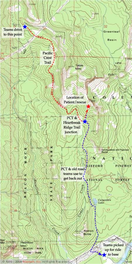
The map below shows the hike in (red dashed line), the location of the hoist rescue (red star), and the hike out (blue dashed line). This mission turned out to be one of the "good" ones... the injury was not life threatening, no other injuries resulted from the operation, and the weather was even nice!. - Return to story - Mission photos